This post is about the stages of the river and how they are formed.
Fig 1. Overall of three main stages of river
1. Upper course
Fig 2. The V-shaped Valley of the upper couse
Most of the rivers begin from the top of the hills and mountains. Since the clouds move upwards air will cool down and form the rain, there will be a lot of rain. When rain falls on the land, some of the water will seep into the soil, and some of it stays on the surface. The water on the surface will flow down and form tiny streams. These streams will gradually join with other streams to form the beginning of the river. The beginning may be a spring, or a marsh or even a glacier. When the river flows down the steep and rocky sides of the hill or mountain, it will get faster and wilder as well as pick up and carries along with the large boulders and rocks. This wearing away of the land is called erosion.
2. Middle course
Fig 3. The meanders of the middle course
As the river continues on its journey the ground starts to have a gentler slope. The river carries on eroding the land, making the river wider and deeper. Bends and turns called meanders then start to form, as the water begins to wears away the sides. The volume of water also increases, as smaller rivers called tributaries also flow in.
3. Lower course
Fig 4. The lower course and end of the river
The river is very wide and deep by the time it reaches its final stage which is lower course. The surrounding land will have also flattened out, making the water slow down, and stones that have been carried along will drop down to the riverbed. It is also at this stage that the river meanders into large horse-shoe shapes, and this is where flooding is most likely to cause problems. When the river comes to an end, it will either flow into a loch or into the sea. This parts is known as the mouth of the river.
Urbanization replaces permeable land surface with impermeable one, which is covered by streets, parking lots, buildings etc. Water will run off the surface rather than being absorbed by soil. Base flow will decrease while overland flow will increase. With more overland flow, river will respond more quickly to rainfall, resulting in a shorter lag time. The construction of sewers during urbanization effectively increases the drainage density, resulting in a higher peak discharge.
Deforestation
Trees lengthen the lag time by intercepting the water. They also increase water infiltration by taking up water by their roots. Deforestation will reduce the interception and water-taking up; there will be more overland flow. Rivers in areas that have been cleared by deforestation will also respond quicker to rainfall, resulting in a higher peak discharge and shorter lag time.
Building of dams
The presence of a dam, will allow flow to be controlled, reducing the risk of flooding and allowing rivers to gradually respond to heavy rainfall in a controlled way; the river has a longer lag time.
Hi guys, today I'll be blogging about hydrographs.
Recap: a hydrograph is a graph that shows the discharge of a point in the river over a period of time, usually to show the change in discharge caused by rainfall. Discharge is just the amount of water that flows through that certain point and is measured in cumecs - cubic meters per second. The significance about hydrographs is that we can find out about the patterns in a certain drainage basin, how much water passes through a point and how long it takes for the water to get there, and from there we can implement protective measures to ward against floods and things like that.
Since all that water has to come from somewhere, let's look back to the hydrological cycle.
Overland flow and through flow all contribute to the amount of water in the drainage basin. The amount of overland flow/surface runoff is dependent on rainwater intensity and the infiltration capacity of the soil. If it's been raining heavily for a while and the soil is already saturated, then it stands to reason that there would be more overland flow. Throughflow is the water that flows horizontally in thesoil (it's different from groundwater flow, that is in, well, groundwater but this is in the soil).The factors that would affect the amount of water would be:
Urbanisation
In this case, we're assuming urbanisation doesn't include drains. (But if there were, it would lead to a longer lag time, because the water takes a longer time to get to the river, or if the drains lead to reservoirs or water storage areas, then a lower peak). Urbanisation would basically entail a concrete jungle, and concrete has really poor permeability. As a result, there would be a lot more water flowing on the surface.
Reforestation
Reforestation would mean more trees, and more interception (and also more evapotranspiration). So there would be less water reaching the surface, and less overland flow. And of course, it would offset some of the carbon in the atmosphere, and become a carbon sink.
Deforestation
The lack of trees would conversely mean less interception, and more water would reach the surface.
Permeability of soil
Very permeable soil means that it is more likely to absorb water and not so permeable soil means that more water would "pass" over it rather than being absorbed. This is assuming that infiltration capacity is constant, because the soil could be very permeable but cannot absorb a lot of water. (If you can think of some more factors, leave it in the comments :>) Since we've already went through in class the factors that affect the lag time and shape of hydrographs, I won't talk about them here.
But I think the thing to note here is that, a lot of human activity is affecting not only the hydrological cycle, but also the discharge in the rivers. In reality, a lot of the floods and water-related disasters could be due us, our need to build buildings, cut down trees and so on. So we should balance our activity with our environmental conscience - because the environment can only take so much and bring the conditions back to equilibrium.
The hydrologic cycle begins with the evaporation of water from the surface of the ocean. As moist air is lifted, it cools and water vapor condenses to form clouds. Moisture is transported around the globe until it returns to the surface as precipitation. Once the water reaches the ground, one of two processes may occur;
1) Some of the water may evaporate back into the atmosphere or
2) The water may penetrate the surface and become groundwater. Groundwater either seeps its way to into the oceans, rivers, and streams, or is released back into the atmosphere through transpiration of the plants. The balance of water that remains on the earth's surface is runoff, which empties into lakes, rivers and streams and is carried back to the oceans, where the cycle begins again.
2. Different Processes of Hydrological Cycle
- Evaporation and Condensation:
Evaporation is the phase change of liquid water into a vapor (gas). Evaporation is an important means of transferring energy between the surface and the air above. The energy used to evaporate water is called "latent energy". Latent energy is "locked up" in the water molecule when water undergoes the phase change from a liquid to a gas. Eighty-eight percent of all water entering the atmosphere originates from the ocean between 60o north and 60o south latitude. Most of the water evaporated from the ocean returns directly back to the ocean. Some water is transported over land before it is precipitated out. When water vapor condenses back into a liquid it releases latent heat, which is converted into sensible heat warming the surrounding air. The warming of the surrounding air fuels uplift to help promote adiabatic cooling and further condensation. As droplets of water coalesce into larger droplets they attain a size big enough to fall towards the earth as precipitation. Located high in the troposphere, rain drops possess a high degree of potential energy that is converted into kinetic energy once they begin to fall toward the surface. Impacting the surface they convert this kinetic energy into work done on the surface (erosion for example).
- Interception and Infiltration
As water reaches the surface in various forms of precipitation, it is intercepted by plants or falls directly to the surface. Precipitation that collects on the leaves or stems of plants is known asinterception. The amount of water intercepted by a plant largely depends on plant form. Water is held on the leaf surface until it either drips off asthrough fallor trickles down the leaf stem finally reaching the ground asstem flow. Interception of falling rain buffers the surface against erosion. Coniferous trees tend to intercept more water than deciduous trees on an annual basis because deciduous trees drop their leaves for a period of time.
Figure 2. Droplets of water intercepted by tree leaf.
Upon reaching the ground, some water infiltrates into the soil, possibly percolating down to the groundwater zone or it may run across the surface asrunoff.Infiltrationrefers to water that penetrates into the surface of soil. Infiltration is controlled by soil texture, soil structure, vegetation and soil moisture status. High infiltration rates occur in dry soils, with infiltration slowing as the soil becomes wet. Coarse textured soils with large well-connected pore spaces tend to have higher infiltration rates than fine textured soils. However, coarse textured soils fill more quickly than fine textured soils due to a smaller amount of total pore space in a unit volume of soil. Runoff is generated quicker than one might have with a finer textured soil.
Vegetation also affects infiltration. For instance, infiltration is higher for soils under forest vegetation than bare soils. Tree roots loosen and provide conduits through which water can enter the soil. Foliage and surface litter reduce the impact of falling rain keeping soil passages from becoming sealed.
3. Importance of the Hydrological Cycle
All the creatures cannot live without water. Approximately three-fourths of the Earth is covered with water. However, of this water, only one percent is the fresh water on which we depend. The fresh water that we use and its continuous replacement are results of the hydrological cycle. Due to hydrological cycle, the quantity of water level in the oceans, rivers, ponds etc are maintained properly.The earth have limited amount of fresh water and if water that evaporate never return back to earth, we would not be living now.
Done by Zeng Jingxuan (16)
Reference:
1. Alguo Dai & Kevin Trenberth, Clouds-Hydrological Cycle Retrieved 23rd April from http://www.tiimes.ucar.edu/highlights/fy06/dai.html
2. Hydrological Cycle. Retrieved 23rd April from http://www.uwsp.edu/geo/faculty/ritter/geog101/textbook/hydrosphere/hydrologic_cycle.html
In this post, I will touch on the efforts of the Singapore government in sustaining our water resources, such as the 4 national taps.
The First Tap (Reservoirs):
Currently, Singapore have 17 reservoirs to collect rainwater and used water as our supply is low, hence it is necessary for us to maximize all resources we have.
I think that this idea is excellent, as well as the government's efforts to build more barrages and reservoirs since the past years.
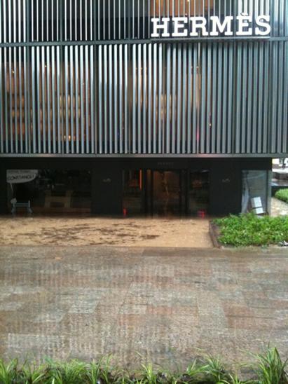
However, I feel that perhaps they should put a little bit more focus on maintainance of our drainage systems, especially those in low lying areas like Orchard Road, which is probably the worst place for a floods to occur as shops will suffer big losses. Everybody, remember those Birkin bags floating out of their shops and Milk Tea everywhere, I'm sure we don't want that to occur again right!
To tackle that problem the stretch of Orchard Road will be raised to decline this issue and so on. Check this video out for a more comprehensive explanation.
The Second Tap (Malaysia):
This is the import of water from Johor, Malaysia to increase our supply, and is under two agreements signed years ago.
These agreements will expire in 2011 and 2061, which Malaysia may not choose to renew them.
Hence, Singapore government is indeed taking measure now to ensure our sustainability even if Malaysia do cut-off our water supply from them.
This is good, as it is better to prepare in advance for the future, then panic in a couple of years time. A method would be the 3rd tap.
The Third Tap (NEWater):
This is a technology developed locally and is our Singapore pride. It makes use of ultra-filtration to recycle used water from our sewage system and is highly sustainable. This is due to that it "cleans" used water, which cannot be used for much purposes, thus after going through the NEWater treatment, not only is it able to be reused again, it will also be contributing to saving the environment, by following 2 of the 3 "R"s, reuse and recycle! In fact, this technology is so highly feasible that oil plants are in Saudi Arabia are said to be using it as well!
Another video I found which briefly shows the processes in this treatment ina cute way: <iframe title="YouTube video player" width="480" height="390" src="http://www.youtube.com/embed/K1rb13g6dTU" frameborder="0" allowfullscreen></iframe>
The Fourth Tap (Desalination Plant)
At this plant, sea water undergoes a pre-treatment process likewise to NEWater to purify it for new consumption.
This is very feasible as Singapore is a island, surrounded by nothing but sea water. What better way than to make use of these vast resources into consumable water for our resources right!
After all, the resource of sea water can be said to be impossible to use up and after all the worries of Singapore sinking due to rising sea levels from global warming, perhaps this is a way to counter that problem!
Just a Quick Note:
Comments on Azirah's post on the Importance of Water:
I feel that her post is very good in listing out all the different uses of water, from in the system(our human bodies) to the universe(the Earth).
I would particularly like to highlight that water makes up around 65% of our bodies, and without it, we will die! Like by dehydration. I feel that this is of the utmost important use of water, as if we mammals don't exist, Earth will be like empty, then there will be no point in tis existence.
Also, I like that she brought up that water is also in our DNA, as we learnt in our biology lesson, the hydrogen bonds between the two nitrogenous bases in the DNA molecule is necessary for DNA replication to occur.
I would also like to add on that without water, water transport will not be possible. Thus this affects globalization!
-Orographic precipitation takes place at mountainous places.
-Some processes take place during Orographic Precipitation: (in order)
-Evaporation:
- of the ocean water creating moist air over ocean surface.
- of ice crystals and air moisture in the cloud when it moves down the leeward slope, creating hot and dry air region at the base of the mountain.
-Adiabatic cooling: (Refer to Chelsia's post for definition)
- Condensation of the water vapour when air rises on the windward slope since air is cooled adiabatically. (Condensationis the change of the physicalstate of matterfrom gaseous phase into liquid phase)
-Precipitation of water vapour occuring when air continues to rise higher on the windward slope. Precipitation will start to fall to the surface, creating a rain shadow.
-Evaporation of the moisture in clouds when the air travels down the slope of the mountain makes air hot and dry. Hence, dry and hot deserts are observed at the end of the leeward slope.
2/ Frontal Precipitation:
Summary of mechanism of Frontal Precipitation
-Warm front: warm air advances towards cold air -> warm air rises and coolds adiabatically -> condensation -> rain
-Cold Front: heavier cold air advances and pushes beneath warm air -> warm air is forced upwards and cools adiabatically -> condensation -> rain
Since the text book mentioned the differences between warm front and cold front but did not specifically state them out, I would touch on those differences as well as types of weather may be produced.
Differences between warm front and cold front:
-By definition,
oWarm front is the boundary between cold air and warmer air that's replacing the cold air
oCold front is the boundary between warm air and colder air that's replacing the warm air.
-A cold front is associated with colder weather and a warm front is associated with warmer weather. Cold front is usually found at a temperature drop's leading edge. Meanwhile, warm front is usually found at a homogenous warm air mass's leading edge.
-Cold fronts can move up to twice as fast as warm fronts can, since cold air is denser and harder to be removed from the earth’s surface than warm air. As a result, cold fronts can produce sharper changes in weather than warm fronts.
-Due to the difference in mechanism, different types of weather are created:
Weather conditions associated with a cold front.
Weather Phenomenon
Prior to the Passing of the Front
Contact with the Front
After the Passing of the Front
Temperature
Warm
Cooling suddenly
Cold and getting colder
Atmospheric Pressure
Decreasing steadily
Leveling off then increasing
Increasing steadily
Winds
South to southeast
Variable and gusty
West to northwest
Precipitation
Showers
Heavy rain or snow, hail sometimes
Showers then clearing
Clouds
Cirrus and cirrostratus changing later to cumulus and cumulonimbus
Cumulus and cumulonimbus
Cumulus
Weather conditions associated with a warm front.
Weather Phenomenon
Prior to the Passing of the Front
Contact with the Front
After the Passing of the Front
Temperature
Cool
Warming suddenly
Warmer then leveling off
Atmospheric Pressure
Decreasing steadily
Leveling off
Slight rise followed by a decrease
Winds
South to southeast
Variable
South to southwest
Precipitation
Showers, snow, sleet or drizzle
Light drizzle
None
Clouds
Cirrus, cirrostratus, altostratus, nimbostratus, and then stratus
Stratus, sometimes cumulonimbus
Clearing with scattered stratus, sometimes scattered cumulonimbus
Please correct me if I'm wrong. If you have any question, please feel free to comment. :) Hope this help your further understanding.